Castles in the Clouds Part 1: Hiking Mount Roberts & Shaw
Hiking Mt Roberts & Mt Shaw in the Lakes Region, NH
- Region: Lakes Region
- Difficulty: Moderate
- Length: 12.3 miles
- Elevation Gain: 2,253 feet
- Trail Map: AllTrails
- Website: https://www.castleintheclouds.org/
Oh Tell Me Why Do We Build Castles in the Sky
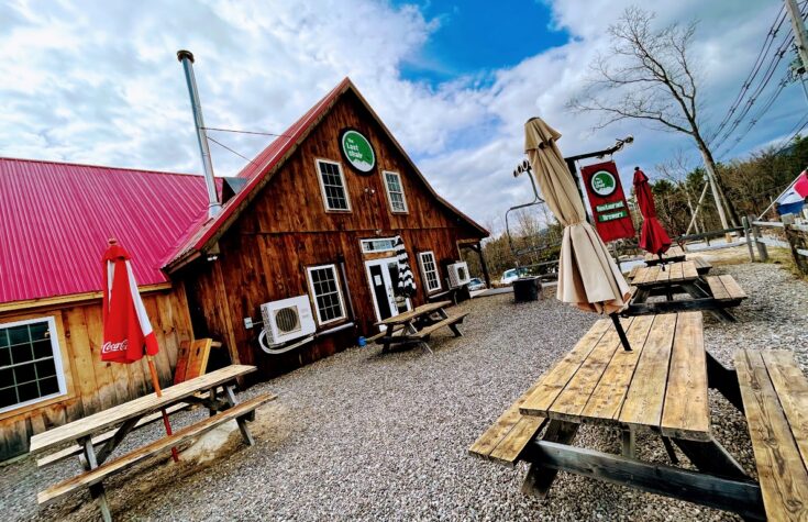
On a hot and humid day in late May with the threat of an afternoon rain shower, we arrived at Castle in the Clouds in Moultonborough, NH. Situated on the slopes of a mountain overlooking Lake Winnipesaukee, the Castle in the Clouds is a sprawling estate famous for its weddings, events and hiking trails.
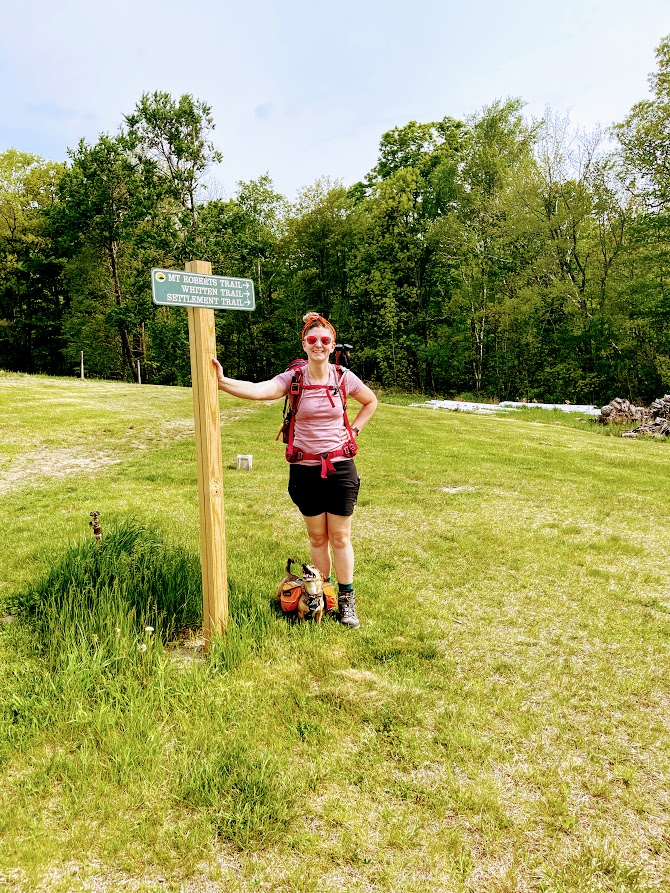
While the visitor’s center was closed, we instead had plans to hike Mt Roberts with the option to loop in Mt Shaw, bagging us two peaks on the 52 With a View list.

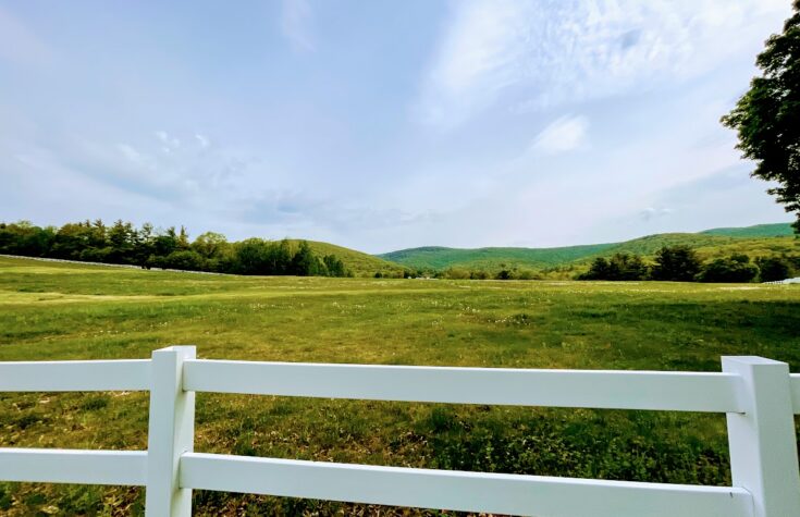
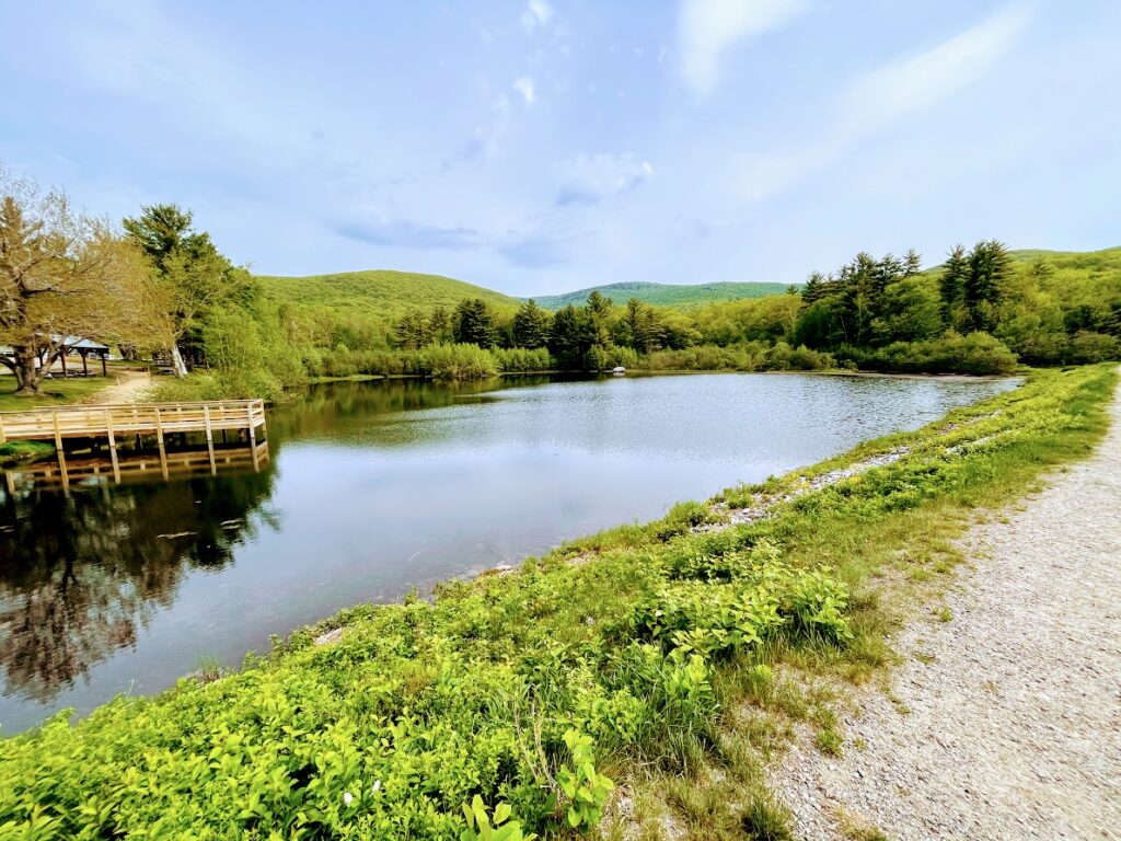
We were able to snag one of the last few parking spots designated for hikers and made our way a small walk to the trailhead. The grounds of Castle in the Clouds are magnificent, making the trailhead for Mt Roberts one of the most scenic. Not only was there a great view of Lake Winnipesaukee, there were large rolling fields, a pond, old rustic buildings and great views of the peaks of Roberts, Shaw and other area mountains. We were in awe even before our hike began.
Hiking Mt Roberts
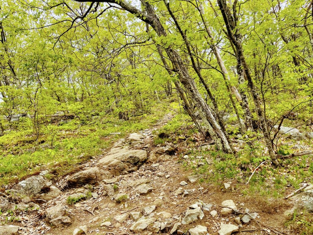
The trail started off near the pond and meandered through the estate. Note that there are a lot of criss-crossing trails, so make sure to double check to see if you’re on the right track. Overall, the trail was wide and easy to follow as we traversed the forest, slowly gaining elevation.
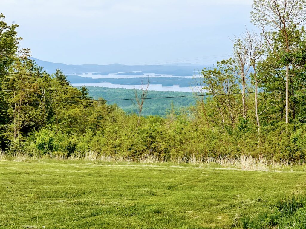
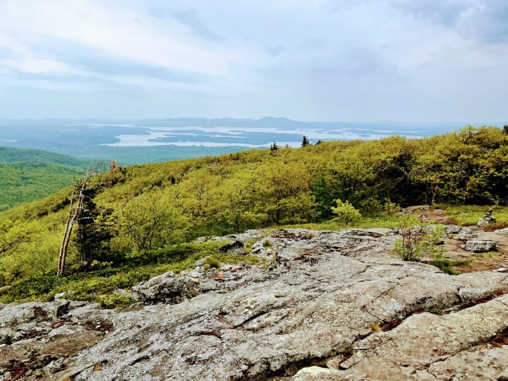
It wasn’t long until we encountered our first viewpoint halfway to the peak, giving us a commanding view of the Lakes Region.
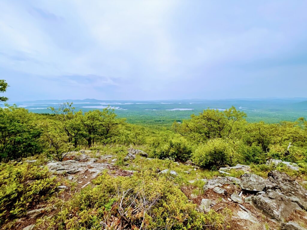
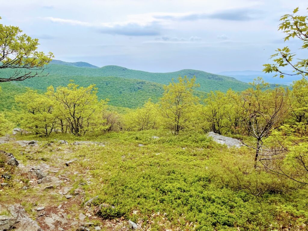
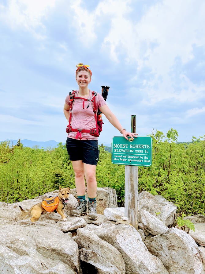
Closer to the summit, the trail conditions shifted from a stone staircase to mostly bald rockface. Nearing the peak, we got another commanding view and a great look at Mt Shaw in the near distance.
At this point, while it was humid and there were some bugs, there was a generous wind keeping us cool and the bugs at bay. We made it to the official summit, which was completely wooded, but did offer limited views for those who stand taller than the treeline.
We were feeling good at that point, so we decided to go for the entire loop. Which we would learn may have not been the best choice.
Along the High Ridge Trail to Mt Shaw
The trail to Mt Shaw was generally wide, well kept with minimal rocks or roots. This is a great trail for cruising along without having to worry too much about your footing.
However, this was also when we started to regret our choice. The wind died down, causing us to subsequently sweat buckets as the flies took this as an invitation to swarm our faces. However, this is black fly season, so these are conditions we should have expected. We highly recommend bringing bug face nets as no amount of bug spray seemed effective against these bastards.
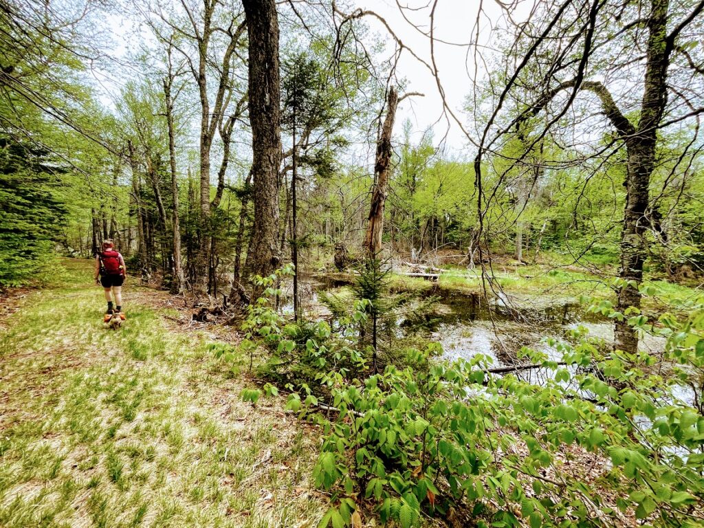
As we walked on, it started to drip and we full heartedly hoped it would downpour and relieve us of the muggy conditions. Alast, it did not downpour so we trudged on. Closer to Mt Shaw, we passed by some pretty swamps as the trail grew wider. For the rest of the way up the mountain, the trail was essentially a grassy dirt road utilized by ATVs and other off-road vehicles.
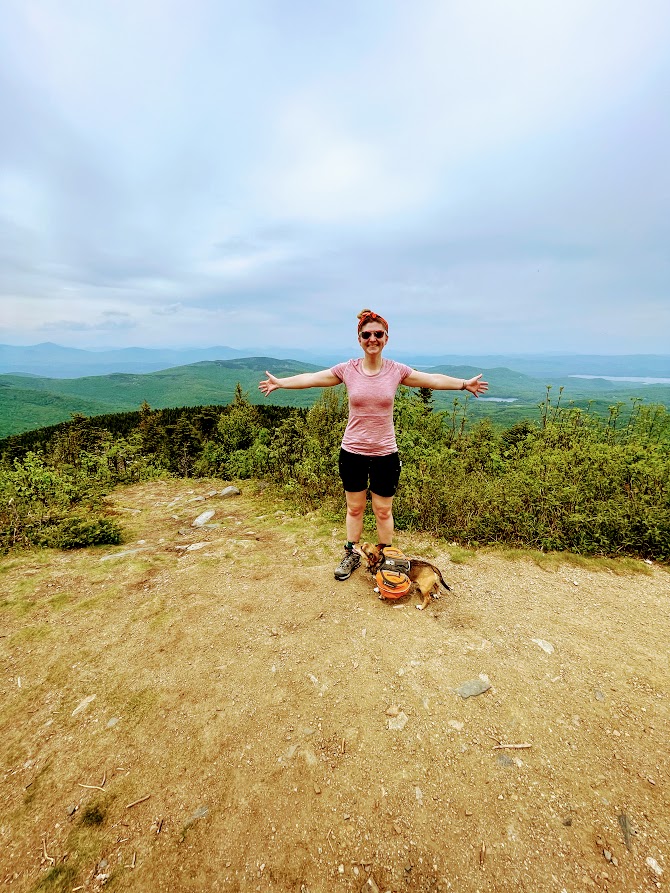
After hiking up the meandering trail to the top of Mt Shaw, we stopped briefly for lunch and to take hazy photos of the Southern White Mountains off in the distance. Unfortunately, the black flies did not allow us any respite so we quickly hurried down the mountain.
Once again there are a lot of crisscrossing trails and it is very easy to take the wrong one. We took the wrong turn and added a few miles to our itinerary, eventually meeting up with a paved carriage road that brought us back to the trailhead.
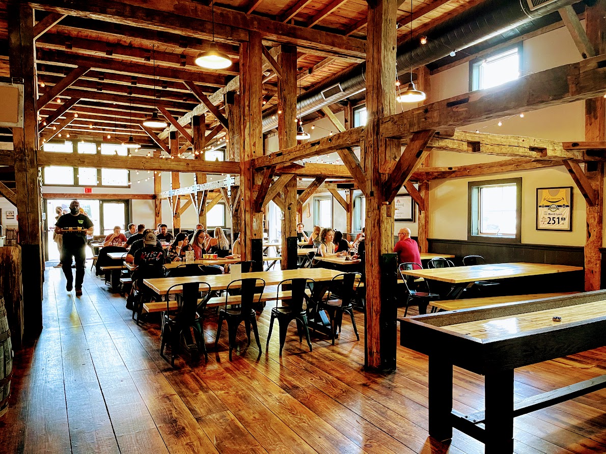
Celebrating at Burnt Timber Brewing
Besides the bugs and the humidity, it is a beautiful hike that’s not too difficult. However, in the conditions we hiked, we felt it wasn’t worth the suffering for the limited hazy views. We both agreed that this would be better done as a winter hike. Not only would flies and the heat not be an issue, the leafless trees would provide a much better view all around.
After surviving being eaten alive and sweating our weight in water, we headed off to Burnt Timber Brewing in Wolfeboro in celebration. As we drove there, it wasn’t long until we encountered slick roads from the downpour we missed. If only we were so lucky for that downpour to relieve us of the humidity and bugs and it might have been a muddier, but more enjoyable hike.
Brad Brad


Boston COVID-19 Map of Breweries Open for Dine in, Takeout and Delivery
Breweries are back open - Awesome! However, if you were expecting to gather the gang up and congregate at the bar like it was 2019, things have changed.
The Last Chair Up Mt Cube
It is Mid-Spring, which means the awkward season between ice and mud in the White Mountains. Trying to avoid the mud and soft slushy snow of higher elevations, we elected to climb...